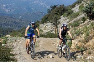
A short yet physical cross country mountain bike ride through mountainous terrain behind Nice, Provence-Alpes-Côte d’Azur.
Route Overview
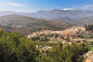
The Levens plateau is already well known amongst hikers from around Nice who take advantage of the reputed hostels and beautiful terrain in this part of the Côte d’Azur, but Mount Arpasse, facing the village, is off their radar and gets a lot less foot traffic.
Despite its modest height (695 m), Mont Arpasse is nevertheless a superb focal point of a mountain bike ride notably because of the superb views over the Var and Esteron valleys. Looking west, you’ll see the pretty hamlet of Plan-du-Var about 500 m below which is linked to Levens by an ancient mule trail.

The Route
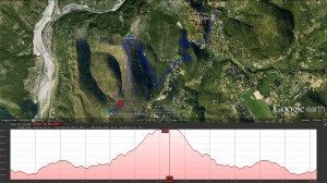
From the village of Levens (520 m), head south down Av. Charles David. At the bottom of the village, head right for 150 m along Vers la Gumba and turn left down Chemin de la Mole and follow down to Sainte-Anne (500 m) and turn right onto the little road leading to the forest fire station.
Just after the fire station, turn left and climb through the woods, which after two switchbacks reaches a plateau with a few houses.
Leave the road and take the trail on the right hand side down to a narrow valley. From there, climb to the ridge at l’Albarée (543 m) marked with an old building.
Continue along the MTB trail, over the gate and climb through a few switchbacks to Mount Arpasse (695 m).
From the summit take the singletrack back down to the ridge, which runs parallel to the climb. At l’Albarée continue your descent via the way you came and continue retracing your route back to Levens.
Alternative descent
For a faster, more technical descent, take the trail that begins just after where the route up meets l’Albarée (543 m). This will take you back down to the valley, and from there it’s a short climb and then a final descent down to the fire station (490 m).
[box type=”info” size=”medium” style=”rounded” border=”full” icon=”https://www.ultimatefrance.com/wp-content/images/icons/gps-icon-xsmall.gif”] GPS Download (GPX File) Google Earth Download (KML File)[/su_box]
Route Notes
- Departure point: Levens (30 km from the coast)
- Altitude at trail start: 520 m
- Length: 9 km
- Climb: 300 m
- Descent: 300 m
- Duration: 2:00 hours
- Difficulty: Average
- Best time to ride: Year round
Getting There
From Nice, head inland up the Var valley for 30 kms via Tourette-Levens.

- From Nice, head northeast on A8
- Take exit 55-Nice-Est toward Nice-l’Ariane/Le Port/La Trinité/Saint-André
- Keep right at the fork, follow signs for D19/Saint-André/Tourrette/Levens
- Turn right onto Quai de la Banquière/D19. Continue to follow D19
- Keep left at the fork. Continue to follow D19
- Slight left onto D519
- Turn left onto Route de la Piscine/D519
- Turn right onto D519
- Turn left to stay on D519
- Turn right onto Av. du Docteur Faraut/D519. Continue to follow D519
- Turn right onto Rue Arthur Malaussena, and you have reached Levens, the start of this bike ride.
[mappress mapid=”5″]

