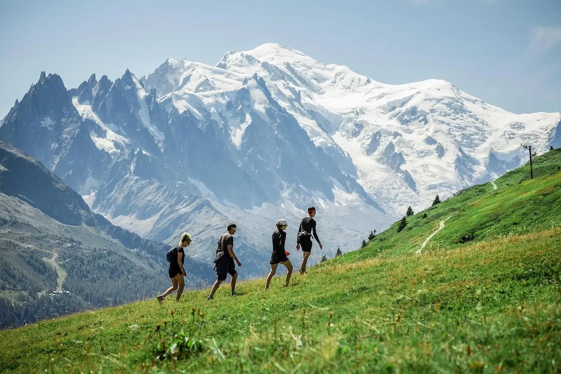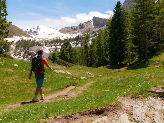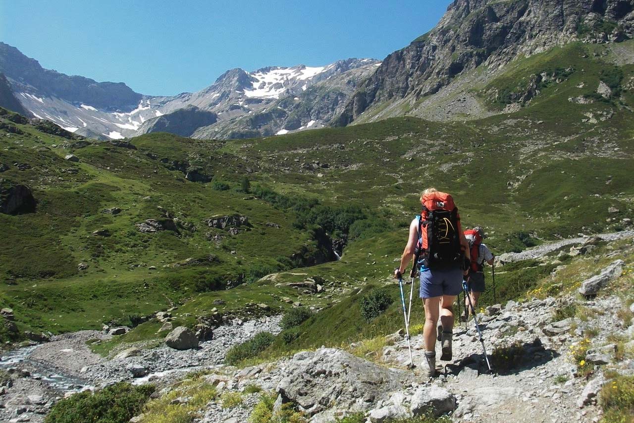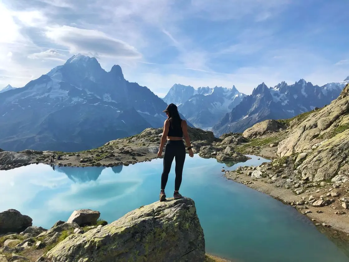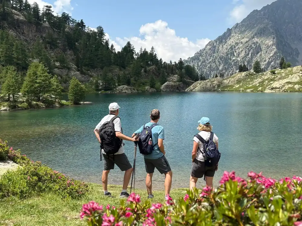
The GR5 through the French Alps is the great long walk of western Europe — around 600 km and more than 31,000 m of climbing, from the shore of Lake Geneva to the Mediterranean at Nice, across 36 stages and ten mountain massifs. Most people take five to six weeks. Most people also get the numbers wrong before they start. This page gives you every stage, every variant and every rule, checked against the trail’s governing association.
Hiking the GR5 end to end is the closest thing Alpine walking has to a thru-hike. You start at lake level, at 374 m, and finish at sea level six weeks later having crossed the Chablais, the Giffre, the Aiguilles Rouges, the Beaufortain, the Vanoise, the Thabor, the Briançonnais, the Queyras, the Haute-Ubaye and the Mercantour. The landscape changes completely three or four times. The cheese changes with it. Of every route in our guide to hiking in the French Alps, this is the biggest undertaking by a distance.
It is also the least understood of the big Alpine routes. The Tour du Mont Blanc is a 170 km loop that everyone can picture. The GR5 is a 2,600 km international trail from the North Sea, of which the Alpine section is one part — and that part has two names, two possible start points, two possible finishes and a set of published figures that contradict each other on the trail’s own website. Sorting that out is the first job of this guide, and it starts in the next section.
ROUTE | STAGES | SECTIONS | WHEN TO GO | REFUGES | COSTS | PLANNING | FAQ
GR5 or Grande Traversée des Alpes?
They are not the same thing, and this is the single most confusing point about the route. The GR5 is an international trail running from Hoek van Holland on the North Sea to Nice on the Mediterranean, crossing the Netherlands, Belgium, Luxembourg, France, Switzerland and France again. The Grande Traversée des Alpes association puts the full length at 2,600 km, though other national federations along the way quote less — the Flemish trail authority says “more than 2,000 km”, French Wikipedia around 2,200 km. Take 2,600 km as the GTA’s own claim rather than a settled fact.
The Grande Traversée des Alpes — the GTA — is the French Alpine section of that trail: Lake Geneva to the Mediterranean, and the only part almost anybody walks. When a British or American hiker says “I’m walking the GR5”, this is what they mean. Confusingly, “Grande Traversée des Alpes” is also the name of the Grenoble-based association that manages and waymarks the route, and there is a separate Italian trail called the Grande Traversata delle Alpi sharing the same initials. Three different things, one name.
Distance: ~600 km
Total ascent: 31,395 m
Stages: 36
Duration: 5–6 weeks
Start / finish: Saint-Gingolph to Nice
Highest point: Col de la Leisse, 2,761 m
Difficulty: Strenuous, non-technical
Season: Mid-June to mid-September
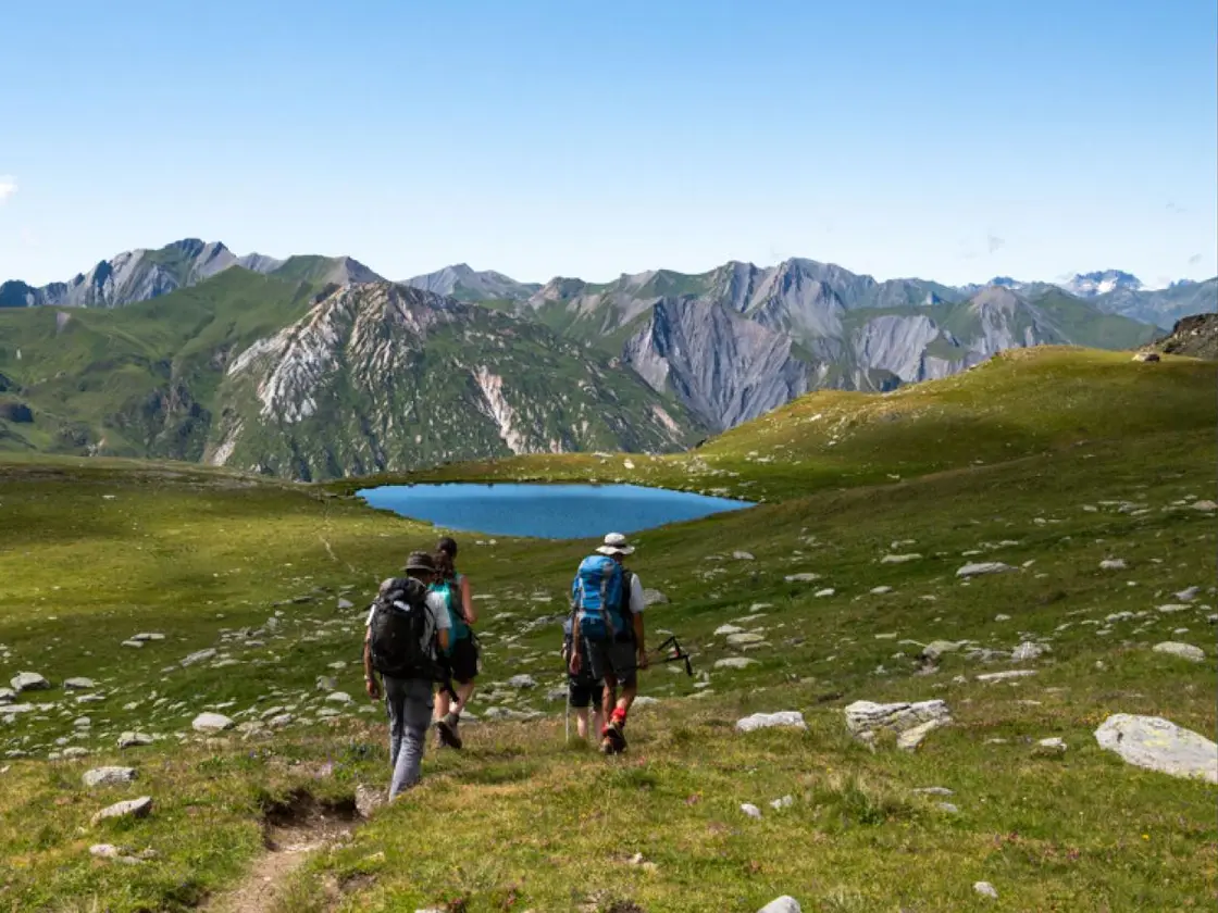
Why the GR5 Distance Keeps Changing
You will see the GR5 quoted at anything from 560 km to 725 km, and nobody explains why. Here is the honest answer. The GTA’s own website publishes 600 km on its homepage and 620 km on its itinerary page. FFRandonnée, the French hiking federation, says around 600 km. But add up the GTA’s own 36 published stage distances and you get 560.8 km; measuring their official GPX track gives about 570 km.
Four things move the number: whether you start at Saint-Gingolph or Thonon-les-Bains, whether you take the GR55 through the Vanoise or stay on the main line, whether you finish in Nice or divert to Menton on the GR52, and how much valley walking and refuge detour gets counted. We use about 600 km throughout this guide, because that is the figure both the trail’s governing body and the national federation prefer. Treat any source quoting 620 km to the kilometre as false precision.
Saint-Gingolph or Thonon-les-Bains?
The official route starts at Saint-Gingolph, a village split down the middle by the Franco-Swiss border on the southern shore of Lake Geneva. The GTA’s first stage is titled “De Saint-Gingolph aux chalets de Bise”, and their GPX track begins in the village at lake level, 374 m.
Thonon-les-Bains is a recognised variant, not the main route. The GTA files it under their variants and describes Thonon walkers as rejoining the main itinerary at the Chalets de Bise on stage 2. It exists because Thonon has a mainline SNCF station and Saint-Gingolph doesn’t, which makes it the easier arrival for most people. Both are legitimate — but the reason you see Thonon quoted as the start so often is that Savoie Mont Blanc’s tourist board page uses it, and most English-language articles have copied that page without checking.
The finish is precise: the GTA puts the official end point at the Maison de l’environnement, 31 avenue Castellane, Nice — a few metres above sea level, after 374 m of lake shore and everything in between.
The Highest Point Depends on Which Route You Take
“What is the highest point of the GR5?” has at least four defensible answers, and which is right depends entirely on which trail you choose. Nobody sets them out together, which is why you will see the figure quoted flatly — and differently — almost everywhere.
On the GTA’s official 36-stage itinerary — the route this guide follows, and the one their GPX track describes — the high point is the Col de la Leisse in the Vanoise, between the Refuge du Col du Palet and the Refuge de la Leisse. Its altitude is itself contested: FFRandonnée’s topo-guide 530 gives 2,758 m, which IGN’s own elevation model agrees with, while Wikipedia and most French walking sites give 2,761 m. Nothing else on those 36 stages comes close — Col Girardin is 2,699 m, the Pas de la Cavale 2,671 m, the Col du Palet 2,652 m.
If you take the GR55 through the Vanoise, you cross the Col de Chavière at 2,796 m — higher than anything on the main line.
If you follow the Val-d’Isère to Bonneval-sur-Arc line, you cross the Col de l’Iseran — and this is where the confusion starts. The GTA publishes that stage itself, under les variantes as the historic line, and calls the col “le point le plus haut de l’itinéraire” — meaning that variant, not the GR5 as a whole. It is also a road pass, the high point of the cyclists’ Route des Grandes Alpes, which shares the Grande Traversée des Alpes name. Its roadside signpost reads 2,770 m; IGN gives 2,764 m. That signpost figure is the one that has spread across the English-language internet, usually attached to the GR5 as a whole rather than to this one variant.
And if you take the Col des Fours variant — which leaves the trail at Val-d’Isère and, according to the Refuge du Fond des Fours, has been waymarked since 2013 to reach Bonneval while avoiding the Fornet ski area — you cross 2,976 m. That is the highest ground any GR5 line touches, and FFRandonnée calls it the highest col crossed by any GR at all. Note the GTA does not publish it as one of its own stages.
One myth worth killing while we’re here: Chavière is not “the highest col on any GR route in France”, however often you read it. Three cols beat it — the Col de la Chamoussière at 2,884 m and the Col Vieux at 2,806 m, both on the Tour du Queyras (GR58), and the Col des Muandes at 2,828 m on the GR57. FFRandonnée manages to crown two different cols on two different pages; the reconciliation is that Chamoussière is the highest col on a GR main line, while the Col des Fours is higher still but sits on a variant.
One more trap. The GTA’s own section 3 page describes the Col Girardin (2,699 m) as “le plus haut col de l’itinéraire” — the highest col on the route. Read as a whole-route claim that is wrong: the Col de la Leisse is 62 m higher and on the same trail. Girardin is the high point of that section. Several English guides have repeated it as a route-wide figure.
The GR5 Does Not Cross the Écrins
Tour operators sometimes list the Écrins among the national parks the GR5 crosses. It doesn’t. The Parc national des Écrins is bounded by the Romanche valley to the north and the Guisane and Durance to the east, and the GR5 stays east of that line throughout, coming no closer than about 10 km near Le Monêtier-les-Bains. Briançon, Névache and Montgenèvre aren’t even park communes, so the route doesn’t touch the buffer zone either. What you do get is a long view of the Écrins from the north on the approach to Briançon.
The trail that genuinely circles that massif is the Tour des Écrins (GR54) — 176 km and around 12,000 m of ascent, generally reckoned the hardest of the classic French circuits. If the Écrins is what you’re after, that’s your route, not this one.
While we’re correcting park lists: FFRandonnée’s own article on the route names four regional parks — the Bauges, the Chartreuse, the Queyras and the Préalpes d’Azur. Three of those four are wrong. The Bauges and Chartreuse sit 38 km and 65 km from the track and belong to the GR96 and GR9; the Préalpes d’Azur lies west of the Var, while the GR5’s final stages run east of it. The GR5 crosses two national parks, the Vanoise and the Mercantour, entering the protected core zone of both, and one regional park, the Queyras.
GR5 or Tour du Mont Blanc?
This is the question most people are really asking when they land here, so let’s answer it directly. The two routes share ground for four days — from the Col du Brévent to the Col de la Croix du Bonhomme — and then they could not be less alike.
| GR5 | Tour du Mont Blanc | |
|---|---|---|
| Shape | Point to point, Lake Geneva to the sea | Circular, back where you started |
| Distance | ~600 km | ~170 km |
| Stages | 36 | 11 |
| Time | 5–6 weeks | 7–11 days |
| Total ascent | 31,395 m | ~10,000 m |
| Crowds | Quiet outside the shared TMB section | Very busy in July and August |
| Booking | Four incompatible systems, 36 nights | Largely one platform, books out months ahead |
| Car | A liability — travel by train | Works fine, you return to it |
Do the Tour du Mont Blanc first if you have never done a multi-day Alpine trek. It is shorter, the infrastructure is better, the logistics forgive mistakes, and it delivers the most concentrated mountain scenery in the Alps. Bear in mind though that it’s also the harder of the two to get a bed on.
Do the GR5 when you want a point-to-point adventure rather than an intensive hike. The TMB circles one massif for ten days; the GR5 crosses nine ranges over five weeks and ends in the sea. You will walk for days without meeting anyone, eat better for less, and watch the Alps change from Savoyard dairy country to Mediterranean scrub. It is not harder per day — the daily ascent is comparable — it’s just a lot longer, and that means it’s both mentally and physically more challenging.
The GR5 Route, Massif by Massif
The Grande Traversée des Alpes association divides the route into four official sections, or tronçons. They are not equal in length or character, and they are the sensible unit for planning — each one starts and ends somewhere you can reach by public transport, which is exactly what you need if you’re walking the trail over several summers rather than in one push.
Distances and ascent below are the sums of the GTA’s own published stage figures for each section. They are lower than the round numbers you’ll see quoted elsewhere, because they’re arithmetic rather than marketing.
1. Chablais and Giffre — Saint-Gingolph to Les Houches
Distance 101.5 km. Ascent 7,101 m. Stages 7. Known for the hardest first day on the route.
Nobody warns you about stage one. You leave the lake shore at 374 m and climb to the Chalets de Bise — 1,701 m of ascent in 12 km, the biggest single climb of the entire GR5, on day one, with a full pack and no acclimatisation. It is a brutal introduction and it catches people out every summer. If you have any doubt about your fitness, this is the stage to split.
After that the Chablais settles into something gentler: limestone pasture, working dairy farms making Abondance cheese, and a route that slips in and out of Switzerland over the Col de Chésery. The Col de Coux and the Col de la Golèse carry you into the Giffre, past Samoëns — a good resupply stop, and a serious mountain-biking base in its own right — before the trail turns south and climbs to the Col d’Anterne (2,257 m) — the moment the walk changes gear. From the Refuge de Moëde-Anterne you get the first full view of the Mont Blanc massif, and the last stage of the section runs over the Brévent ridge and drops 2,069 m into the Chamonix valley.
This is quiet country for the most part. You’ll meet more cows than hikers until you reach the Aiguilles Rouges, and then suddenly you’re in one of the busiest mountain valleys in Europe.
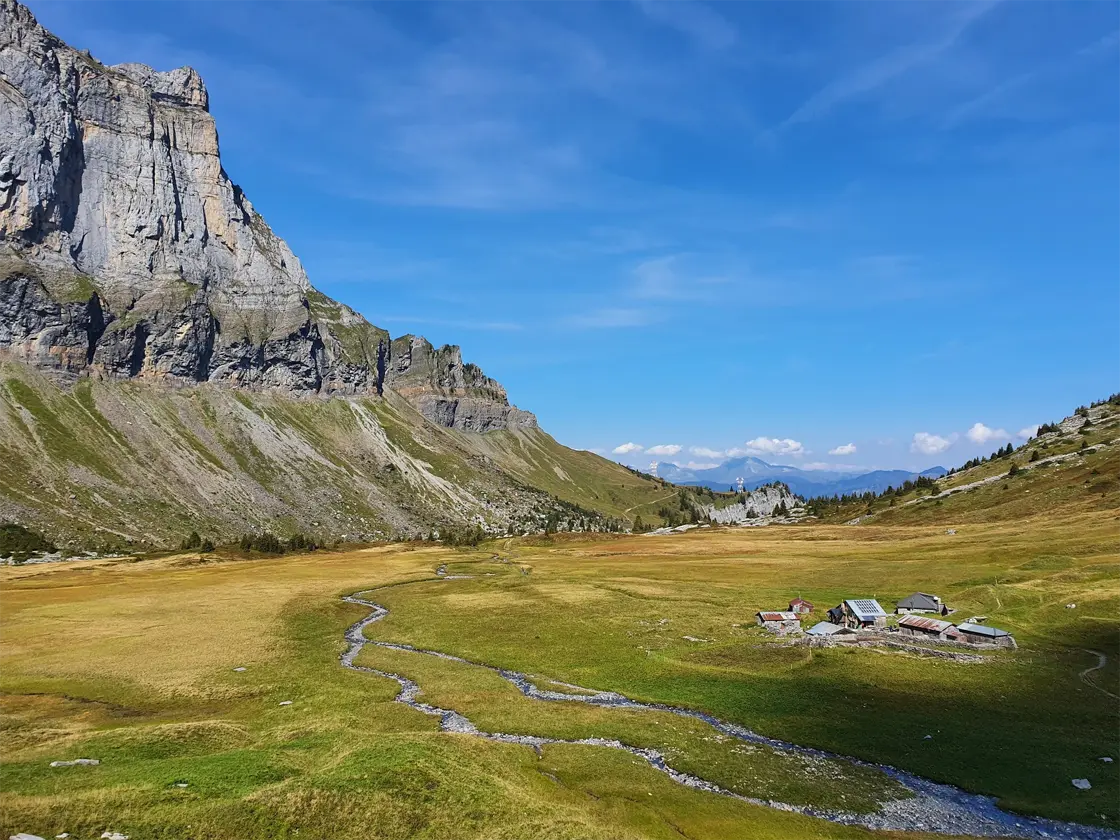
2. Mont-Blanc, Beaufortain and Vanoise — Les Houches to Modane
Distance 158.1 km. Ascent 8,341 m. Stages 10. Known for the highest ground on the route.
The longest and, for most people, the best section. It opens with the stretch the GR5 shares with the Tour du Mont Blanc: from the Col du Brévent through Les Houches, over the Col de Voza, past Nant-Borrant and up over the Col du Bonhomme and the Col de la Croix du Bonhomme — the col itself is 2,408 m, though the path crosses higher ground at about 2,479 m beside the refuge at 2,443 m, which is why guidebooks quote the larger figure. Expect company — this is the busiest trail in the Alps in July and August. The two routes part at the Croix du Bonhomme, where the TMB drops west to Les Chapieux and the GR5 goes east over the Col de la Sauce and along the exposed crête des Gittes into the Beaufortain.
The Beaufortain is the route’s underrated stretch: rounded green mountains, the Lac de Roselend, and the best cheese in the Alps made in the valley below. Then the trail climbs into the Vanoise, and the character changes completely — bare rock, glaciers, ibex, and the highest sustained walking on the GR5. Over three stages you cross the Col du Palet (2,652 m), the Col de la Leisse (2,761 m) — the true high point of the main route — and traverse below the Glacier de l’Arpont with the Grande Casse at 3,855 m filling the skyline.
This is also where you choose. At the Col du Palet the GR55 branches off through the heart of the Vanoise over the Col de Chavière; the main GR5 stays east. Both end at Modane. More on that decision below.
Important for 2026 and beyond: the Refuge de la Croix du Bonhomme closed to the public on 17 August 2026 for a complete rebuild and is not expected to reopen until summer 2029. If you’re walking this section after mid-August in any year before then, you’ll need to re-plan that night — most walkers now push on to Les Chapieux or shorten the previous day.
3. Thabor, Briançonnais, Queyras and Haute-Ubaye — Modane to Larche
Distance 144.7 km. Ascent 8,206 m. Stages 10. Known for sunshine, larches and sundials.
South of Modane the Alps dry out and open up. The trail crosses the Thabor massif and drops into the Vallée Étroite — Italian territory until 1947, and it still feels it, with Italian spoken in the refuges and pasta on the menu. From there the route runs down the Clarée to Plampinet, over to Montgenèvre and into Briançon, the highest town in France and a genuine resupply point with shops, banks, a station and Vauban’s fortifications.
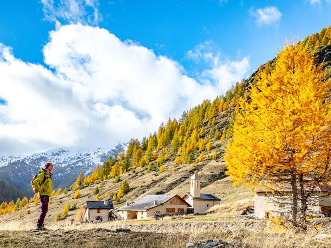
Then the Queyras, which many walkers rate the best week of the whole trail. It gets around 300 days of sunshine a year, the villages are built of larch and stone with painted sundials on the walls, and the walking is high but forgiving. Château-Queyras sits on a rock in the middle of the valley with a Vauban fort on top of it. If you like this section, the Tour du Queyras (GR58) is the loop that explores it properly — and the same valleys carry some of the best mountain biking in the Southern Alps if you ever come back on wheels.
The section finishes across the Col Girardin (2,699 m) — the highest col on this stretch and often snowbound well into the season — down to Maljasset and out through the Ubaye valley to Larche, a small border village a long way from anywhere.
4. Mercantour to the Mediterranean — Larche to Nice
Distance 156.5 km. Ascent 7,747 m. Stages 9. Known for the walk into the sea.
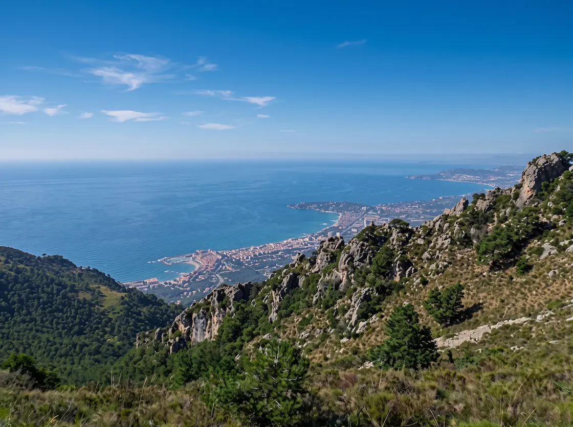
The last section is the one people remember. It opens with the Pas de la Cavale (2,671 m), the highest point in the Mercantour section, and crosses into a landscape that is recognisably Mediterranean within two days — thyme, lavender, dry stone, and light that changes the colour of everything. The Mercantour National Park is where wolves came back to France: two were confirmed in the vallon de Mollières in November 1992, having recolonised the Alps under their own steam from the Italian Apennine population. They were never reintroduced, whatever you may have read — and they are no longer confined here either, with the national population now put at around 1,080 animals spread across roughly a tenth of the country.
The route descends the Tinée valley through Saint-Étienne-de-Tinée and Saint-Sauveur-sur-Tinée, then makes a decision at Saint-Dalmas-Valdeblore: three stages straight down to Nice, or the higher, wilder GR52 to Menton. If you stay on the GR5, the final days run over Utelle and Levens and into Nice through the back of the city — a strange, brilliant ending where alpine trail becomes suburb becomes seafront. The last stage is 24.5 km and finishes at the Maison de l’environnement on avenue Castellane.
Be honest with yourself about the last two days. After five weeks in the mountains, walking into a city of 350,000 people is an anticlimax for some and a triumph for others. Plenty of walkers finish at Levens and take the bus in. Nobody will think less of you, and the Côte d’Azur is right there when you want a swim.
The GR5 Stage by Stage — All 36 Stages
This is the full official stage breakdown, with distance and ascent for every one of the 36 stages. The figures come from the Grande Traversée des Alpes association’s own published itinerary — the body that manages and waymarks the route. No guidebook is required to read this table, which is the point: everyone else puts it behind a book or a booking.
A word on conventions. Stage counts differ wildly between sources, and it matters which one you’re reading. The GTA lists 36 stages across its four sections, and FFRandonnée’s own article says 36 — though the GTA’s prose still describes the route loosely as “une quarantaine d’étapes”. Cicerone’s guidebook uses 28, because it combines several short days. Tour operators use whatever fits a week. We use the GTA’s 36 throughout, because it is the only breakdown that matches the official GPX files, the refuge spacing and the section boundaries. If you’re strong, you will combine stages; almost everyone does somewhere.
Section 1: Saint-Gingolph to Les Houches
| # | Stage | Distance | Ascent |
|---|---|---|---|
| 1 | Saint-Gingolph → Chalets de Bise | 12 km | +1,701 m |
| 2 | Chalets de Bise → Refuge de Trébentaz | 12.8 km | +1,171 m |
| 3 | Refuge de Trébentaz → Refuge de Chésery | 13.5 km | +609 m |
| 4 | Refuge de Chésery → Refuge de la Golèse | 15.1 km | +652 m |
| 5 | Refuge de la Golèse → Gîte de Salvagny | 15.1 km | +299 m |
| 6 | Gîte de Salvagny → Refuge de Moëde-Anterne | 14.8 km | +1,587 m |
| 7 | Refuge de Moëde-Anterne → Chamonix / Les Houches | 18.2 km | +1,082 m |
| Section total | 101.5 km | +7,101 m |
Section 2: Les Houches to Modane
| # | Stage | Distance | Ascent |
|---|---|---|---|
| 8 | Les Houches → Refuge du Fioux | 7 km | +695 m |
| 9 | Refuge du Fioux → Nant-Borrant | 15.4 km | +663 m |
| 10 | Nant-Borrant → Plan de la Lai | 14.8 km | +1,135 m |
| 11 | Plan de la Lai → Refuge de la Balme | 12.8 km | +991 m |
| 12 | Refuge de la Balme → Peisey-Nancroix | 22.2 km | +825 m |
| 13 | Peisey-Nancroix → Refuge du Col du Palet | 14.7 km | +1,297 m |
| 14 | Refuge du Col du Palet → Refuge de la Leisse | 20.5 km | +847 m |
| 15 | Refuge de la Leisse → Refuge de l’Arpont | 18.5 km | +675 m |
| 16 | Refuge de l’Arpont → Plan Sec | 16 km | +801 m |
| 17 | Plan Sec → Modane | 16.2 km | +412 m |
| Section total | 158.1 km | +8,341 m |
Section 3: Modane to Larche
| # | Stage | Distance | Ascent |
|---|---|---|---|
| 18 | Modane → Refuge du Thabor | 15.8 km | +1,422 m |
| 19 | Refuge du Thabor → Plampinet | 22.6 km | +624 m |
| 20 | Plampinet → Montgenèvre | 16.4 km | +1,073 m |
| 21 | Montgenèvre → Briançon | 8.9 km | +162 m |
| 22 | Briançon → Brunissard | 21.2 km | +1,426 m |
| 23 | Brunissard → Château-Queyras | 8.9 km | +289 m |
| 24 | Château-Queyras → Ceillac | 13.5 km | +958 m |
| 25 | Ceillac → Maljasset | 13.6 km | +1,055 m |
| 26 | Maljasset → Fouillouse | 10.5 km | +383 m |
| 27 | Fouillouse → Larche | 13.3 km | +814 m |
| Section total | 144.7 km | +8,206 m |
Section 4: Larche to Nice
| # | Stage | Distance | Ascent |
|---|---|---|---|
| 28 | Larche → Bousiéyas | 20.3 km | +1,233 m |
| 29 | Bousiéyas → Saint-Étienne-de-Tinée | 16.8 km | +661 m |
| 30 | Saint-Étienne-de-Tinée → Roya | 13.8 km | +1,023 m |
| 31 | Roya → Refuge de Longon | 19.2 km | +1,322 m |
| 32 | Refuge de Longon → Saint-Sauveur-sur-Tinée | 12.3 km | +47 m |
| 33 | Saint-Sauveur-sur-Tinée → Saint-Dalmas-Valdeblore | 12.3 km | +1,077 m |
| 34 | Saint-Dalmas-Valdeblore → Utelle | 25.1 km | +1,013 m |
| 35 | Utelle → Levens | 12.2 km | +727 m |
| 36 | Levens → Nice | 24.5 km | +644 m |
| Section total | 156.5 km | +7,747 m |
Route total: 560.8 km and 31,395 m of ascent across 36 stages. That ascent figure is simply the sum of the GTA’s own per-stage numbers, and it is the most defensible total available — it sits neatly between FFRandonnée’s “30,000 m” and the raw figure you get from measuring the official GPX, and it is traceable stage by stage rather than dependent on how a piece of software smooths the elevation data.
A few honest caveats about the official data, because we checked it rather than copying it. The GTA’s section 3 page heads itself “130 km et 9 étapes” but then lists ten stages totalling 144.7 km. Sections 1 and 2 do the same thing more quietly, heading themselves 108 km and 166 km against stage sums of 101.5 km and 158.1 km. In each case the headline is wrong and the stage list is right. Section 4’s stage 30 shows 13.8 km in the summary list and 16.4 km in the detail block below — and that second figure, along with its time and both ascent and descent, is a verbatim copy-paste of section 3’s Plampinet-to-Montgenèvre stats. The 13.8 km is the right one; their own GPX for the stage measures exactly that. Section 4 also runs its stage descriptions 1 to 7, then 9, then 8. The stage, section and full-route GPX files all download complete and measure within a rounding error of their published distances.
GR55, GR52 and the Variants Worth Taking
The GTA officially recognises exactly three variants: the Thonon-les-Bains start, the GR55 through the Vanoise and the GR52 finish to Menton. Two of those are real decisions that change your walk.
GR55 — the High Route Through the Vanoise
Where it leaves the Col du Palet. Where it rejoins Modane. Length 54–57 km, 3–4 days. High point Col de Chavière, 2,796 m.
The GR55 cuts through the middle of the Vanoise while the main GR5 skirts its eastern edge. It is shorter and higher: over the same ground the main route covers 71.2 km in four stages, so the GR55 saves you roughly 15 km, though both lines are usually walked in four days. In exchange you get the Col de la Vanoise at 2,517 m directly beneath the Grande Casse, the village of Pralognan, and the Col de Chavière — at 2,796 m, the highest col crossed by any GR route in France.
Two things to know. First, the split isn’t as clean as it sounds: the GR5 and GR55 share ground from the Col du Palet as far as the Refuge de la Leisse, so the Col du Palet is where you decide, not where the paths part. Second, the GTA never calls it “the GR55” — on their site it’s the itinéraire historique du GR5, because it was the original line. Same path, two names, which is why searching for it is confusing.
Take it if you want the highest and most dramatic Vanoise crossing and you’re walking after early July. Skip it if you’re early in the season — snow lingers at Chavière and it is not unusual to find névés right at the col even in high summer. There is no published clearing date for it, and anyone who gives you one is guessing.
Bivouac warning specific to the GR55: bivouac in the Vanoise core zone is only permitted beside certain refuges — and the two on this variant, Col de la Vanoise and Péclet-Polset, are not among them. If you’re carrying a tent, the GR55 is the wrong choice. The main GR5 line passes several huts where bivouac is authorised, including l’Arpont, Col du Palet and la Leisse.
GR52 — Finishing at Menton Instead of Nice
Where it leaves Saint-Dalmas-Valdeblore. Where it finishes Menton. Length about 95 km; FFRandonnée gives 5–6 days in its stats box and seven in its own suggested itinerary. Versus Nice the main GR5 covers 61.8 km in three stages from the same point, so Menton adds around 33 km and two to four days.
This is the better finish if you have the time, and most experienced walkers say so. Rather than descending steadily towards a city, the GR52 climbs back into high country for the Vallée des Merveilles — a glacial basin beneath Mont Bégo holding roughly 40,000 carved signs across 17 km², made between about 3,300 and 1,800 BC with most dating from the Early Bronze Age, listed as a monument historique since 1989. You pass the Refuge de Nice, the Madone de Fenestre and the Refuge des Merveilles before dropping through Sospel to the sea at Menton.
The engravings zone has its own regulations on top of normal national park rules, and they are stricter than people expect. Leaving the marked path is prohibited unless you are with a guide holding the agrément Merveilles, who may take up to fifteen people off the waymarked line — which is a genuine argument for hiring one here rather than a nicety. Metal-tipped trekking poles are banned unless you fit rubber tips. Touching or walking on the engravings is banned. Bivouac is banned across the whole zone except beside the Merveilles and Fontanalba refuges. A guide will also show you engravings you would walk straight past. You do not need one to walk the GR52 through the zone on the marked path — but you do need one to see the site properly, which is a different claim from the one some operators make.
GR52 is not GR52A. These are different trails and the confusion is widespread — the GTA’s own variant page gets it wrong. GR52 runs Saint-Dalmas-Valdeblore to Menton, which is the finish described here. GR52A is the “Panoramique du Mercantour”, running inland from the Col de Tende to Colmars, and never reaches the sea. FFRandonnée’s topo-guide 507 states the distinction plainly.
GR5E and Other Branches
The GR5E, known locally as the Chemin du Petit Bonheur, runs 45 km from Bonneval-sur-Arc down the Haute-Maurienne valley to Modane, joining the GR5 there. It is a low-level route following the historic Arc valley trade road towards Italy, and it is a genuinely good bad-weather alternative if the high Vanoise is out of condition — though it is a branch reaching the GR5, not a loop off and back onto it, since the main GR5 never visits Bonneval.
Two trails you will see mentioned alongside the GR5 are not variants of it at all. The GR56 is the Tour de l’Ubaye, a standalone loop of around 152 km meeting the GR5 near Larche. The GR57 is the Tour du Mont Thabor from Névache, 84 km, which shares waymarking with the GR5 for a stretch near the Vallée Étroite. Both are worth knowing about if you want to extend a section into a loop.
One myth to put down: there is no recognised GR5 variant via the Lac de la Sassière. It comes up in forum posts, but no official source lists one, and the GTA’s Tarentaise stages run Peisey-Nancroix to the Col du Palet without going near it. Similarly, “the Névache variant” isn’t a variant — the main GR5 already runs through the Clarée valley via Plampinet, which is part of the commune of Névache.
Hiking the GR5 in Sections
Most people who complete the GR5 do it over several summers, not in one five-week push — and almost nobody writes for them. Every blog is a thru-hike account and every operator sells you a week. If you have a job, a family, or a sensible amount of annual leave, walking the trail in one-week chunks is not a compromise. It is arguably the better way to do it.
The case for it is practical. You get better weather odds, because a washed-out fortnight ruins a thru-hike but only dents one section. You can walk each range in the month that suits it — the Chablais in late June when the flowers are out, the Mercantour in September when the heat has gone. You spread the cost across years. And you arrive fresh each time instead of grinding through week four on tired legs.
Where to Break the Walk
The right split points are chosen by transport access, not by guidebook chapter. Here is every practical break on the route, with what actually serves it. Note how the picture changes south of Briançon — this is the single biggest constraint on sectional planning and nobody flags it.
| Break point | After stage | Access |
|---|---|---|
| Saint-Gingolph | Start | Bus from Évian (line 10, becomes line 4 in Sept 2026), or Swiss rail to St-Gingolph CFF |
| Samoëns | 5 (near) | Bus only — Cars Région Y94 from Cluses station |
| Les Houches / Chamonix | 7 | Rail — Mont Blanc Express (Les Houches is a request stop) |
| Les Contamines-Montjoie | 9 (near) | Bus — Cars Région Y84 from Saint-Gervais-les-Bains-Le Fayet |
| Peisey-Nancroix | 12 | Rail nearby — Landry / Bourg-Saint-Maurice |
| Modane | 17 | Rail — mainline TGV |
| Briançon | 21 | Rail — including the Paris-Austerlitz night train |
| Ceillac | 24 | Bus — Zou! 572 from Mont-Dauphin-Guillestre |
| Larche | 27 | Bus only, and awkward — nearest station 48 km over the Col de Vars |
| Saint-Étienne-de-Tinée | 29 | Bus — Lignes d’Azur line 91 from Nice, €1.70 |
| Saint-Dalmas-Valdeblore | 33 | Bus — GR52 decision point |
| Nice | 36 | Rail and air |
The GR5 Over Four Summers
The GTA’s four official sections happen to be well chosen for exactly this, because each one begins and ends somewhere reachable. This is the plan we’d recommend, and it needs roughly nine to eleven days each year including travel.
Summer one — Saint-Gingolph to Les Houches. Seven stages, 101.5 km. The gentlest section in terrain if you survive day one, and it finishes in Chamonix, which makes for an easy journey home and a good excuse to stay a couple of days. Late June or early July.
Summer two — Les Houches to Modane. Ten stages, 158.1 km, and the big one: the Mont Blanc massif, the Beaufortain and the high Vanoise. Rail at both ends and a bail-out at Peisey-Nancroix if the weather turns. Mid-July to late August, because the Vanoise cols need to be clear.
Summer three — Modane to Larche. Ten stages, 144.7 km, through the Clarée, Briançon and the Queyras. If ten days is too many, split it at Briançon: Modane to Briançon is four stages, rail to rail, and is the single best short week on the whole GR5 for anyone travelling car-free.
Summer four — Larche to Nice. Nine stages, 156.5 km, finishing at the sea. Getting to Larche is the hardest logistics on the route — plan it properly, or start this section at Saint-Étienne-de-Tinée and accept you’ve skipped two stages. September is ideal: the heat has broken and the Mercantour is at its best.
If you only ever walk one section, make it the Queyras — Briançon to Larche, six stages. Sunshine, sundials, larch villages and the Col Girardin, with a proper town at one end. It is the stretch thru-hikers most often say they wish they’d walked slower.
When to Hike the GR5
The GTA’s own guidance is that the Alpine walking season runs June to October, and that most refuges open from 15 June to 15 September. That fifteen-week refuge window is what really sets your dates, not the weather. In the southern Alps — the Queyras, the Ubaye, the Mercantour — the season runs noticeably longer at both ends.
Mid-July to early September is the reliable window for a full thru-hike. Everything is open, the high cols are usually clear, and you can walk the whole route without improvising. That is also when the refuges are fullest, so the trade-off is real.
Late June is beautiful and risky. The flowers are extraordinary, the Chablais and Beaufortain are at their best, and you’ll have the trail largely to yourself. But the high Vanoise cols may still hold snow, and several refuges haven’t opened. In 2026 — a below-average snow year — the Vanoise national park was still reporting significant snowpack above 2,000 m at the end of May, and advising crampons and an ice axe. Take that seriously: it was a light winter.
September is the connoisseur’s month for the southern half. The light is better, the heat has gone from the Tinée, and the larches turn gold in the Queyras from about mid-month. The catch is that refuges start closing from early September and — a detail the GTA flags and nobody else does — village shops in some places shut down from the end of August. Resupply that worked in July may not work in September. Check ahead, and carry a day’s slack.
One hard legal date. In the Mercantour, the GR5 through the vallon de Sallevieille is closed to the public from 31 October to 30 April every year — by a municipal order of the commune of Beuil, on account of rockfall. That is the firmest date on the entire route — it is not a recommendation, it is a prohibition.
We are deliberately not telling you which week the high cols clear. No official source publishes a snow-clearing date for any col on the GR5 — not the GTA, not the national parks, not FFCAM — because it varies by two or three weeks from year to year. Anyone who gives you a confident date is guessing. What you can do instead is check the Parc national de la Vanoise and Parc national du Mercantour sites for current conditions in the fortnight before you leave, and ask the refuges directly. They know.
Two cols to watch specifically: the Col de Chavière on the GR55, where the park itself warns of late snowfields right at the col, and the Col Girardin above Ceillac, which the GTA notes can stay snowbound late in the season, with an alternative line below the Tête de Girardin when it is.
Refuges, Gîtes and How Booking Actually Works
GR5 accommodation is more varied than people expect. The GTA’s own directory lists something close to a hundred places to stay along the route, and the GTA’s directory counts refuges, gîtes d’étape, campsites, hotels and chambres d’hôtes together — so the widely-quoted “100 refuges and gîtes” overstates the mountain-hut count. What matters more than the number is that they are run by four different organisations with four different booking systems that do not talk to each other. This is the thing English-language guides never explain, and it is the single most useful thing to understand before you start.
The Four Kinds of Bed
FFCAM refuges belong to the Fédération Française des Clubs Alpins et de Montagne, which owns and maintains about 120 refuges and chalets in France, run by 40 of its 450 local alpine clubs. On the GR5 these include Plan de la Lai in the Beaufortain, Maljasset in the Ubaye, Rabuons above Saint-Étienne-de-Tinée, and Col de la Vanoise and Péclet-Polset on the GR55. Booking runs through each hut’s own ffcam.fr subdomain — chaletplandelalai.ffcam.fr, refugecoldelavanoise.ffcam.fr and so on. There is a shared back end behind them, so one account and one payment system covers the lot, and the same route handles unguarded winter nights. But there is no single page where you check availability across every FFCAM refuge at once: you go hut by hut.
Parc national de la Vanoise refuges — the Col du Palet, la Leisse and l’Arpont on the main line — are owned by the national park, and each books through its own page. Watch for a trap here: refuges-vanoise.com looks like a central Vanoise system but is actually the Tour des Glaciers de la Vanoise hut group. Of the three on your route, only l’Arpont is on it — and even there the site asks you to book one refuge at a time.
Private refuges and gîtes d’étape are family or company businesses — the Refuge de Bise, Alfred Wills, Moëde-Anterne, Bousiéyas. They book direct, or through a regional platform: monrefugepaysdumontblanc.com around Mont Blanc, montourduqueyras.fr in the Queyras, itineranceubayemercantour.fr in the Ubaye and Mercantour. Worth knowing: “gîte d’étape” is not a protected term. There is no legislative definition of it, though since 2020 many fall under the Code du tourisme’s auberge collective category and some are classed as meublés de tourisme. Standards vary enormously.
Unwardened refuges (refuges non gardés) are open outside the guarded season with no staff. Payment is still mandatory, increasingly online. Distinct from a cabane, which is free and cannot be booked at all.
What Demi-Pension Includes — and What It Doesn’t
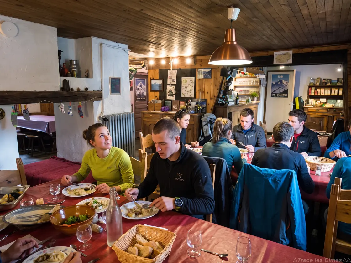
Demi-pension is dinner, a dormitory bed and breakfast. Dinner is communal, served at a set time, and usually generous — soup, a main, cheese, dessert. Breakfast is bread, jam and coffee. The packed lunch is not included, and this catches people out: a panier repas costs a further €10–15 and normally has to be ordered the night before.
Prices below were checked in August 2026 against each establishment’s own published tariff, except where noted. Private refuges and gîtes on the GR5 run roughly €52–62 for demi-pension — Bousiéyas €52, Alfred Wills €53, Bise €56, Golèse €55 in the summer dormitory, Salvagny €56 per person in a shared room (still shown as a 2024/25 tariff at the time of writing). The three Vanoise park refuges cluster at €59 in high summer — though la Leisse is listed at €57 on the park’s own record and €59 on its own page, and all three are dearer in spring. Note that park refuges publish no member rate at all. FFCAM huts mostly price à la carte rather than as a package: Plan de la Lai is €19 for the bed, €24 dinner, €11 breakfast, which composes to about €54, plus around €0.88 tourist tax.
FFCAM membership halves the adult bed, never the meals. For adults it is exactly 50% of the guarded-season nightly rate, and we verified it across five huts on the route: Plan de la Lai €19.00 public / €9.50 member, Maljasset €19.50 / €9.75, Col de la Vanoise €27.50 / €13.75, Péclet-Polset €27.00 / €13.50, Merveilles €22.00 / €11.00. Meals cost everyone the same, and the halving does not hold outside the guarded season — hors-gardiennage rates run to a third off, or a flat rate for everybody. If your itinerary uses FFCAM huts regularly in summer, the saving is €10–14 a night — check the current membership fee against the number of nights you’ll actually spend in them before joining.
Booking, and the Cash Problem
Booking is mandatory at most wardened refuges and online-only at several — the Col de la Vanoise states it flatly, and Plan de la Lai says bookings are made essentially online. At the other extreme, the Refuge de Bise takes bookings by email only and wants a deposit by post. Assume nothing about the system until you’ve looked at the individual hut.
How far ahead? We won’t give you a number, because no official source publishes one. What we can tell you is that the Col de la Vanoise opened its summer 2026 bookings in November 2025, so a six-to-nine-month horizon is at least technically available for the popular Vanoise huts. The GTA says only that you should “book or call ahead”. For July and August on the Mont Blanc and Vanoise sections, book as early as you can and don’t assume you’ll walk in.
Carry cash. A surprising number of refuges on this route do not take cards at all — the Refuge de Bise (cash or cheque), the Col du Palet and la Leisse, Péclet-Polset, Rabuons and the Refuge des Merveilles all say so explicitly. Maljasset is cash or cheque too. Plan for several consecutive nights without a card machine and without an ATM, particularly between Modane and Larche. The gîte at Bousiéyas taking cards is the exception, not the rule.
Refuge de la Croix du Bonhomme is closed. It shut to the public on 17 August 2026 for a full rebuild and is not due to reopen until summer 2029. It appears in most GR5 and Tour du Mont Blanc itineraries still in circulation. If you’re planning stage 10 or 11, plan around it.
What the GR5 Actually Costs
Budget €75–95 a day walking hut to hut, which puts a full 36-stage GR5 at roughly €2,700–3,400 for accommodation and food alone. Here is where that goes, using the 2026 prices above.
| Item | Per day | Note |
|---|---|---|
| Demi-pension | €52–75 | €59 is typical; FFCAM huts cheaper with membership |
| Packed lunch (panier repas) | €10–15 | Not included — order the night before |
| Coffee, beer, extras | €5–15 | Optional, and you will not skip it |
| Tourist tax | ~€1 | Charged per night nearly everywhere |
| Realistic daily total | €75–95 | Before transport and gear |
On top of the daily rate, allow for the fixed costs. The four FFRandonnée topo-guides covering the route are €18.40 each, so about €74 for the set. If you want paper IGN TOP25 maps for the whole trail that’s seventeen sheets in IGN’s own GR5 pack, or nineteen with the Chamonix and Thonon sheets, at roughly €14.30 each — €243 to €272, and close to a kilo of paper to carry. Most people buy the topo-guides and use digital mapping. Add rail and bus at both ends, and a rest-day hotel or two.
Self-Organised Versus a Tour Operator
This is the comparison nobody publishes, so here it is plainly — and the single most useful thing on this page if you are about to book. Take the Lake Geneva to Chamonix week, which almost every operator sells, and the same six walking days cost anything from €605 to €1,375 depending purely on who you buy it from.
| Lake Geneva to Chamonix, self-guided | Price |
|---|---|
| Organise it yourself at demi-pension rates | ~€450–550 |
| Altitude Montblanc | €605 |
| Grand Angle | €605 |
| Allibert Trekking | €655 |
| High Point Holidays (without luggage transfer) | €910 |
| High Point Holidays (with luggage transfer) | €1,150 |
| Macs Adventure | €1,375 |
The French operators — Allibert, Grand Angle, Altitude Montblanc, La Balaguère, Terres d’Aventure — sell the GR5 as domestic walking and price it accordingly. The English-language ones sell it as an expedition. Macs Adventure at €1,375 is more than double the French market rate for an identical week, and roughly three times what the same nights cost if you book them yourself. That is not a criticism of the product; it is a fact worth knowing before you pay it.
The premium is real and sometimes worth paying — you get booked beds, a route pack, and somebody to call when a refuge cancels on you. But shop across the French operators before you buy from an English-language one, because the same week is on sale at half the price in French.
Where an operator genuinely earns the money is the booking problem. Reserving thirty-six nights across four incompatible systems, several of them email-only and one of them post-a-cheque, is a genuine slog in a second language. If that is the part you dread rather than the walking, paying somebody is a reasonable decision. Baggage transfer is a different question — it works in the valleys but not between high refuges, so on the GR5 it buys less than it does on the Tour du Mont Blanc.
One more line item that isn’t optional: travel insurance that actually covers mountain walking. Check that your policy covers trekking to 3,000 m and helicopter evacuation — many standard policies do not, and the GR5 spends a lot of time above 2,500 m.
Getting to the GR5 and Home from Nice
The GR5 is one of the best long-distance trails in Europe for car-free travel, and you should treat that as a feature rather than a limitation. It is a linear route: a car left at the start is a liability for five weeks, and a car left at a mid-route break is worse, because you have to come back for it.
Reaching the Start
Saint-Gingolph has no French railway station, which is the practical reason so many people start at Thonon instead. There are two good ways in. The Swiss station — St-Gingolph CFF, on the other side of the village — is served roughly hourly by RegionAlps from the Valais, so flying to Geneva and taking Swiss rail round the lake works well. The alternative is the bus from Évian-les-Bains.
Two live warnings on both of those, checked August 2026. The Évian bus is line 10 only until 31 August 2026; from 1 September 2026 the network is restructured, the route is renumbered line 4 and the operator changes from SAT to Transdev. Numbers are being recycled, so “line 4” today is a different route entirely — check the date your timetable was published. And on the Swiss side, the Monthey–St-Gingolph section is closed from 2 to 31 August 2026 for track renewal, with replacement buses.
The most enjoyable arrival is the GTA’s own suggestion: take the train to Lausanne and cross Lake Geneva by CGN boat. Starting a 600 km walk by stepping off a lake steamer is a considerably better opening scene than a bus station.
If you start at Thonon-les-Bains instead, it’s straightforward: mainline SNCF, direct from Geneva or via Bellegarde, and you rejoin the official route at the Chalets de Bise on day two.
Getting Home, and the Southern Bottleneck
Nice is the easiest finish imaginable — mainline TGV, an international airport, and the sea. Finishing at Menton on the GR52 is nearly as good, with frequent trains along the coast. Check out our detailed guides to Nice and the Côte d’Azur.
Mid-route, the transport picture is excellent in the north and awkward in the south. North of Modane you’re never far from a station. Briançon is the last easy one, and it’s a good one — it has the Intercités de Nuit sleeper from Paris-Austerlitz (not Gare de Lyon), which also calls at Mont-Dauphin-Guillestre. Check that one carefully before you rely on it: engineering work has hit the Austerlitz corridor hard, and in March 2026 roughly three-quarters of scheduled runs were replaced by coach.
Mont-Dauphin-Guillestre is the strategic hub of the southern GR5. Six Zou! Proximité lines terminate there — 570 Risoul, 571 Vars, 572 Ceillac, 573 Abriès-Ristolas, 574 Arvieux and 575 Molines/Saint-Véran — plus the night train. It is how you reach Ceillac and most of the Queyras. Learn this station; it solves most southern logistics.
Larche is the hard one. The nearest station is Mont-Dauphin-Guillestre, about 48 km away — but that measurement goes over the Col de Vars, which closes in winter. Out of season the practical railhead becomes Borgo San Dalmazzo on the Italian side, roughly 66 km away over a lower pass. Either way you’re finishing the journey by road: Zou! line 535 runs Gap to Barcelonnette, and the Ubaye valley operates three free summer shuttles from 4 July to 30 August 2026. Don’t confuse those with the cross-border Demonte–Barcelonnette shuttle that also calls at Larche — that one costs €5 a journey, runs on about fifteen selected dates, and requires a reservation.
Many sectional walkers sensibly start the final section at Saint-Étienne-de-Tinée instead, which is reached by Lignes d’Azur line 91 from Nice for a flat €1.70 — one of the great transport bargains in the Alps.
Two things most GR5 pages get wrong. First, bus numbering has churned. Cluses–Samoëns is Cars Région Y94, Nice–Saint-Étienne-de-Tinée is Lignes d’Azur 91 — the old number 740 survives only on third-party journey planners — and regional services around Briançon were absorbed into the ALTIGO network in September 2023, running as lines 5 (Montgenèvre), 6 (Le Monêtier and Serre Chevalier) and 7 (Névache). Second, the Train des Pignes (Nice–Digne) is not running end to end: trains run Nice to Saint-André-les-Alpes only, with a replacement coach beyond, and full service is planned for spring 2027 once the Moriez tunnel is repaired.
Other useful connections: Samoëns via Cars Région Y94 from Cluses station; Les Contamines-Montjoie via Cars Région Y84, which runs Sallanches–Le Fayet–Saint-Gervais–Les Contamines, so you can join it at Le Fayet or Saint-Gervais; Beaufort via Mobilités Arlysère line 21 from Albertville; and Saint-Martin-Vésubie on the GR52 via Lignes d’Azur line 90, with the seasonal “Été Vésubie” service running 4 July to 20 September 2026 on reservation — daily until 30 August, then weekends only through September.
Guided and Self-Guided GR5 Treks
If the thirty-six-night booking problem is what’s stopping you, a guided or self-guided section is a sensible way in — particularly for a first trip, or if your French isn’t up to a phone call with a refuge gardien in August.
What you are buying is the booking, not the walking. An operator reserves your beds across the four incompatible systems, hands you a route pack, and gives you somebody to call when a refuge cancels on you in August. On the GR5 that is worth more than it is on most trails, because the admin is genuinely heavy. What they cannot sell you is baggage transfer between high refuges — it works in the valleys and nowhere else — so read the itinerary carefully before assuming your pack is being carried.
If you do book a guided section, look for an accompagnateur en montagne for walking terrain or an IFMGA guide if your itinerary touches anything glaciated. A local guide reading the snowpack on a col in late June is worth considerably more than the day rate. And check what happens if a col is out of condition — the good operators reroute, the poor ones cancel the day.
Where to Stay Before and After
At the start. Saint-Gingolph is a small village with limited beds, so most walkers spend the night before in Thonon-les-Bains or Évian-les-Bains and take the early bus round the lake. Thonon is the more practical of the two — it has the mainline station, a proper choice of hotels across all budgets, and supermarkets for last-minute supplies. Évian is prettier and pricier. If you’d rather wake up on the start line, Saint-Gingolph itself has a handful of small hotels and chambres d’hôtes on both the French and Swiss sides of the border — book these well ahead, because there are very few of them.
At the finish. You will arrive in Nice filthy, but fit and extremely pleased with yourself, and you should book somewhere decent in advance rather than trudging round the Vieux Nice with a rucksack. Hotels in Nice range from hostels near the station to seafront places on the Promenade des Anglais; the area around Gare de Nice-Ville is cheapest and best for an onward train, while Vieux Nice puts you two minutes from the sea. Prices climb steeply in July and August, so book the last night early even if the rest of your trip is improvised.
Mid-route rest days. Three places on the trail are worth a night in a real bed rather than a dormitory: Chamonix after section one, Briançon after the Clarée, and Saint-Étienne-de-Tinée in the Mercantour. All three have laundry, banks, gear shops and restaurants, and all three are places where a rest day genuinely restores you. Chamonix in particular is worth two nights — see our guide to hiking in Chamonix for what to do with the spare day.
Planning Your Hike
Maps, Guidebooks and GPX
There is a free, official GPX download for the whole route. The Grande Traversée des Alpes association publishes the complete track plus per-section and per-stage files on its own website — no account and no payment needed. Take the full-route file from the download button rather than the one the interactive map loads: the map version is a heavily simplified track for rendering, roughly a thirtieth of the size. All 41 files — full route, four sections, 36 stages — download complete.
The FFRandonnée topo-guide numbers you’ll see quoted are usually wrong. The correct chain for the GR5 through the Alps is 504 (Léman to the Vanoise), 530 (the Vanoise, including GR55 and GR5E), 531 (Maurienne to the Ubaye) and 507 (the Mercantour, covering the GR5 and the GR52). They’re €18.40 each. For the record, 505 is the Tour du Queyras GR58 and 506 is the GR51 Balcon de la Méditerranée, long out of print — different trails entirely, and neither has ever been a GR5 volume, though both get cited as one. FFRandonnée publishes no single-volume GR5 guide.
Covering the route in IGN TOP25 at 1:25,000 takes seventeen sheets, and IGN sells exactly that set as a GR5 pack: 3528ET, 3530ET, 3531ET, 3532OT, 3532ET, 3633ET, 3534OT, 3634OT, 3535OT, 3536OT, 3537ET, 3538ET, 3639OT, 3640ET, 3641ET, 3741OT and 3742OT. Add 3630OT (Chamonix) if you want the Brévent crossing covered properly, 3428ET only if you start at Thonon rather than Saint-Gingolph, and 3841OT if you finish on the GR52. At roughly €14.30 a sheet the full nineteen come to about €272, and close to a kilo of paper — which is why most people carry the topo-guides and use digital mapping for the detail. IGN also publishes sheet 89024 “Grande Traversée des Alpes” at 1:220,000, but that’s a planning overview, not a walking map. Watch for “3533ET” in older articles — it’s a phantom number; the Tignes sheet is 3633ET.
IGNrando’ is gone. IGN’s route-sharing platform closed on 20 November 2025 and its data-recovery portal shut in May 2026 — any guide telling you to get GR5 tracks from ignrando.fr is out of date. IGN points users to Cartes IGN instead. It is free, and there is no paid tier — but it cannot cache the 1:25,000 raster offline for licensing reasons, so it is not a substitute for paper or a proper offline mapping app. Its vector Plan IGN base map can be cached.
Reading French Waymarking
The GR5 is waymarked end to end by FFRandonnée volunteers, and the system is simple once you know it — but it is not the same as British or American trail marking, and nobody explains it to English-speaking walkers. The marks are painted rectangles roughly 10 × 2 cm, at about 150 m intervals, on rocks, trees, posts and walls.
White over red means you are on a GR route and going the right way. A flash angled left or right above the two rectangles means the path turns — follow the direction of the angle. Two rectangles crossed to form an X means wrong way: stop and go back. That X is the mark people miss, because instinct says a painted mark means “this way”.
Colour tells you which network you’re on, and this matters on the GR5 because the route braids constantly with local paths. White and red is a GR. Yellow and red is a GRP — a grande randonnée de pays, a regional loop. Yellow alone is a PR, a local day walk. Following a yellow flash because it happens to point the way you’re going is the classic error, and it will quietly take you somewhere else entirely.
Parking and Why You Should Not Drive
The GR5 is linear, and that changes the parking question completely. On a circuit like the Tour du Mont Blanc you park at the start and collect the car at the end. Here, a car left at Saint-Gingolph is 600 km from you five weeks later, on the wrong side of the Alps, and retrieving it costs a day and a long train fare. This is the single most common planning mistake on the route, and no other GR5 guide addresses it.
There are three sensible approaches. Don’t drive at all — the trail is exceptionally well served by rail at both ends, and this is what most thru-hikers do. Park at the finish and travel to the start, so the car is waiting when you’re tired rather than stranded when you’re fresh; leaving it near Nice and taking the train north works, though long-stay city parking for five weeks is expensive. Or, if you’re walking in sections, park at a rail-served break point and do an out-and-back over two trips.
That last option is why the rail-versus-bus distinction in the section table above matters so much. Les Houches, Chamonix, Landry, Bourg-Saint-Maurice, Modane and Briançon all have stations, so you can drive to one, walk to another, and train back to your car in a couple of hours. South of Briançon that stops working — Ceillac, Larche, Bousiéyas and Saint-Étienne-de-Tinée are all bus-only, and Larche is 48 km from the nearest station over a pass that shuts in winter. For the southern half, plan on public transport or accept a much longer retrieval.
Where hotels and gîtes at the trailhead offer parking for guests, that is usually the most secure option and worth asking about when you book your first night — but confirm the arrangement covers the whole period, not just the night you’re staying.
What to Pack
Walking hut to hut, aim for 7–9 kg including water. You need no tent, no sleeping bag and no stove. Walking with a tent instead pushes you towards 12 kg and, given the bivouac restrictions in both national parks, buys you less freedom than you’d expect.
Essentials: broken-in boots with a stiff enough sole for scree, a waterproof jacket and overtrousers, a warm mid-layer even in August, sun hat, warm hat and gloves for the cols, trekking poles, a headtorch, sunglasses and high-factor sun cream — the UV above 2,500 m is fierce and you will be up there most days. Carry at least 1.5 litres of water capacity; the southern sections between Larche and the Tinée get genuinely hot and dry.
Refuge kit: a silk or cotton sleeping bag liner is required almost everywhere, earplugs are non-negotiable in a twelve-bunk dormitory, plus a quick-dry towel and light shoes for the evening. Cash in reasonable quantity, for the reasons above.
For the layering system and the packs that handle five weeks of this, see our technical hiking gear guide and our guide to hiking backpacks — a 40–50 litre pack is the right size for a hut-to-hut GR5.
Training and Fitness
The GR5 is not technically difficult — no rope, no glacier, no scrambling beyond the occasional cabled step. What it demands is endurance. The average stage carries about 870 m of ascent, and the hardest carry twice that, and you do it again the next day, and the day after that, for five weeks.
The honest benchmark: if you can walk 20 km with 1,000 m of ascent carrying 8 kg, and get up and do something similar the following morning without your legs objecting, you’re ready. If you can’t yet, you have a training target rather than a problem. Start at least three months out, build to one long hill day a week with a loaded pack, and — this is the part people skip — train back-to-back days. Consecutive-day fatigue is what ends GR5 attempts, not any single stage.
Two practical notes. First, add 20–25% to guidebook time estimates for your first week until you know how you compare to French walking times, which tend to assume a brisk pace and no photographs. Second, the biggest single day is day one, at 1,701 m of ascent — arguably the worst possible ordering for an unacclimatised walker. Consider splitting it, or spending a night at altitude beforehand.
At 2,761 m the high point is well below the altitude where sickness usually becomes a concern, but you will feel the thin air on the Vanoise cols in the first week.
Park Rules, Massif by Massif
The rules change three times along the GR5, and the differences are not cosmetic. A French national park has a zone cœur — a core zone with legally enforceable rules and real fines — and an aire d’adhésion, a buffer zone where — as the parks themselves put it — the decree creates no particular environmental regulation. As a walker you will feel no restriction there, though the park charter still binds the member communes’ planning decisions. The Queyras is different again: it’s a parc naturel régional, which has no core zone and no rule-making power of its own at all. Its ten communes issue near-identical municipal orders that permit bivouac under conditions rather than banning it, and the genuine no-go areas come from prefectural orders — a total bivouac ban in the vallon de Bouchouse around the Foréant and Egorgéou lakes, and a 20 m corridor either side of the path in the Ristolas-Mont-Viso nature reserve. Most English-language guides blend all three into one vague paragraph.
| Vanoise (core) | Mercantour (core) | Queyras (PNR) | |
|---|---|---|---|
| Dogs | Banned, even on a lead. €135 fine | Banned, even on a lead or carried | Allowed; lead required near herds and on alpages |
| Bivouac | Only beside certain refuges, in season, with a booking, 19:00–08:00 | 19:00–09:00, more than an hour’s walk from the boundary or nearest road; one night per spot | Tolerated more than an hour from a village, pitched after 18:00, down by 09:00 |
| Camping | Prohibited | Prohibited, whatever the shelter | Restricted by national planning law, not by the park |
| Drones | Banned. €135 fine | Banned throughout the core | Not banned outright; prohibited within 200 m of wildlife, refuges, lakes and livestock |
| Fires | Banned | Banned; portable stoves permitted | Banned within 200 m of woodland; total ban during the période rouge, which also bans smoking |
| Picking | Banned — plants, fruit, insects, minerals | Minerals, fossils and animals banned. Berries 1 litre (1 Aug–15 Sept), génépi 80 stems a year (August) but génépi noir banned outright, mushrooms 5 litres a season | Not specified |
Note the three different bivouac windows — 19:00–08:00, 19:00–09:00 and 18:00–09:00. They are genuinely different rules, and competitor guides routinely quote one for all three parks. The GTA’s own generic page adds a fourth version; the individual parks’ own pages are the ones to trust.
The dog rule catches people out badly. In both the Vanoise and Mercantour cores, dogs are banned even on a lead — and in the Mercantour, even carried. There is no workaround. Assistance dogs are exempt with the appropriate card. If you walk with a dog, the GR5 through the two national parks is not available to you, though the Queyras is.
In the Vanoise, bivouac is permitted beside a defined list of refuges that includes l’Arpont, the Col du Palet and la Leisse on the main GR5 — but not the Col de la Vanoise or Péclet-Polset on the GR55. The national parks are not the only protected ground you cross. The GR5 also passes through at least four national nature reserves, each with its own rules: Sixt-Passy and Passy around the Col d’Anterne, and Contamines-Montjoie on the shared Tour du Mont Blanc section. Depending on the line you take over the Col du Brévent you may also clip the Aiguilles Rouges reserve. The dog rule differs between them, which is easy to get caught by: leashed dogs are allowed in Contamines-Montjoie but banned outright in Sixt-Passy and the Aiguilles Rouges. In Contamines-Montjoie bivouac is banned below 2,500 m and you must use the designated area at La Balme, for which booking is obligatory and free.
Safety and Mountain Rescue
The emergency number in France is 112 — not 999, not 911. It works from a locked or SIM-less phone, and the operator routes you to whichever unit is on duty. If the signal is too weak for a voice call, 114 takes emergency SMS, which is genuinely useful on this route. Resist the urge to save a direct PGHM number: rescue duty rotates, and you may reach the unit that is off this week.
Who comes depends on where you are. The PGHM (Peloton de Gendarmerie de Haute Montagne), CRS Montagne and the fire service’s mountain units share the work, and the arrangement is set département by département rather than by massif — weekly alternation in Isère, the Hautes-Alpes, Savoie and the Alpes-Maritimes, a single service in some départements, mixed crews in the Haute-Savoie. On a full GR5 you pass through several different arrangements without noticing.
Will you be billed? Almost certainly not — but “rescue is free in France” is not quite the law, and it is worth knowing the shape of it. The statute that lets communes charge, article L.2331-4 of the CGCT, covers “any sporting or leisure activity”, which on its face includes walking. The implementing decree, however, still names only downhill and cross-country skiing, and the Interior Ministry’s position is that billing is confined to the ski domain. So a hiker rescued on the GR5 is not charged in practice. What does get billed is a rescue outside that framework — several resort communes charge for off-piste call-outs, and an evacuation you request for convenience rather than injury is a private helicopter booking, not a secours.
That may change. In February 2026 the Cour des comptes recommended that mountain rescue be billed in whole or in part before the end of 2028, citing 9,912 call-outs in 2024 at a cost of at least €10,780 each. It is a recommendation about targeted interventions, not a proposal to end free emergency rescue — but the direction of travel is clear enough to be worth watching.
In any case, what is never free is everything after the winch. The ambulance, the hospital, the treatment and the repatriation are billed normally, and that — not the helicopter — is the honest reason to carry insurance. Standard travel policies frequently exclude trekking above a stated altitude, and the GR5 spends most of its days between 2,000 m and 2,800 m. Check explicitly for hiking to at least 3,000 m, for repatriation, and for what the policy says about unguided activity. Our guide to travel insurance for France covers what to look for.
The practical hazards on the GR5 are unglamorous and predictable. Afternoon thunderstorms build fast in July and August, and you do not want to be on a col at 3pm — start early, which is why refuge breakfast is rarely later than half past seven. Lingering snow on north-facing slopes below the cols is the main early-season risk; a hard névé across a steep slope is genuinely dangerous without an axe. Patous — the big white livestock guardian dogs — are common on the alpages throughout the southern half: stop, stay calm, don’t run, hold your poles point-down against your body rather than raising them, and walk a wide arc around the flock.
Tell somebody your plan for each stage. The refuges are the safety net on this route — if you’ve booked and don’t arrive, someone notices, which is one more argument for booking rather than winging it.
Frequently Asked Questions
The full route from Lake Geneva to Nice is 36 official stages, which most walkers complete in five to six weeks including rest days. Strong hikers combine stages and finish in around four weeks. Most people who complete the GR5, though, walk it in sections over several summers — the four official sections take roughly 8, 11, 11 and 10 days respectively.
Physically demanding but not technically difficult. There is no rope work, no glacier travel and no scrambling beyond the occasional cabled step. What it asks for is endurance: the average stage carries around 870 m of ascent, and the hardest carry over 1,700 m, repeated day after day for five weeks. If you can walk 20 km with 1,000 m of ascent carrying 8 kg and repeat it the next morning, you are ready.
The Col de la Leisse at 2,761 m, in the Vanoise between the Refuge du Col du Palet and the Refuge de la Leisse. Many sources give the Col de l’Iseran at 2,770 m, but that is a road pass on the cyclists’ Route des Grandes Alpes and it sits nearly 9 km away from the walking route. If you take the GR55 variant you cross the Col de Chavière at 2,796 m, the highest col on any GR route in France.
No, and most people do not carry one. The route is served by close to a hundred refuges, gîtes d’étape and hotels, so you can walk hut to hut with a 7–9 kg pack. A tent buys less freedom than you would expect, because bivouac is tightly restricted in both national parks — permitted only beside certain refuges in the Vanoise, and only between set hours and well away from roads in the Mercantour.
Budget €75–95 a day walking hut to hut, which puts the full 36 stages at roughly €2,700–3,400 for accommodation and food. Demi-pension runs €52–75 at private refuges and gîtes and about €54 at FFCAM huts, with the packed lunch a further €10–15 on top. A tour operator selling the same walking week typically charges two to three times what organising it yourself costs.
Yes, and it is how most people who finish the route actually do it. The Grande Traversée des Alpes association divides the trail into four official sections, each starting and ending somewhere reachable by public transport, which makes a four-summer plan straightforward. Choose your breaks by transport rather than by guidebook chapter — Les Houches, Modane and Briançon all have railway stations, while Ceillac, Larche and Saint-Étienne-de-Tinée are bus-only.
Nice is the official finish, three stages and 61.8 km from Saint-Dalmas-Valdeblore. The GR52 to Menton covers about 95 km, which FFRandonnée puts at five to six days in one place and seven in another, so it adds around 33 km and two to four days. Menton is the better walk — it climbs back into high country through the Vallée des Merveilles and its prehistoric rock engravings — but that zone carries strict rules, including an outright ban on leaving the marked path.
Yes at most wardened refuges, and several accept bookings online only. There is no central booking system: FFCAM huts each book through their own individual website, Vanoise park refuges book through refuges-vanoise.com, and private gîtes book direct or through regional platforms. No official source states how far ahead to book, but the Col de la Vanoise opened its summer 2026 reservations in November 2025, so book as early as you can for July and August.
Planning a GR5 walk and want a second opinion? Leave a comment below — whether it’s about which section to start with, how to reach Larche without losing a day, refuge booking, or whether to finish at Nice or Menton. If you’ve walked it and spotted something here that’s changed on the ground, please tell us; this page gets updated. Bonne route!